GeoBase SDK |
Learn more about Verizon Connect GeoBase.
Get information about the latest release
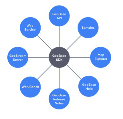 | Verizon Connect GeoBase is a geospatial mapping software development kit (SDK) used to create location-based desktop and web-based applications. Using GeoBase you can design your applications with .NET, ASP.NET and JavaScript. As well as the GeoBase API, the GeoBase SDK comprises a host of tools, demonstrations, sample code, tutorials, and documentation. After installing the GeoBase SDK, you will have access to:
|
GeoBase is a geospatial mapping SDK used to create location-based applications. GeoBase applications can be deployed on servers and desktops. GeoBase takes the complexity out of geospatial software development and offers a scalable, stable, foundation for building applications that leverage spatial data for geographies around the world. Services provided by GeoBase include:
|  |
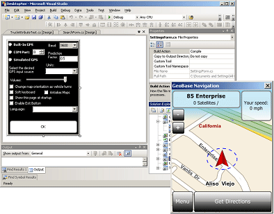
Verizon Connect GeoBase Map Explorer is a simple GeoBase Map Control application that allows you to get a feel for the functionality provided by GeoBase, such as:
Map Explorer can be a starting point for your own applications, a test bench for ideas or just a learning tool. The source code for the entire application is available to you; you are free to use this code any way you like. | 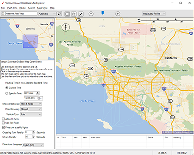 |
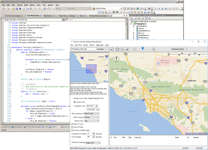
WorkBench is an IDE combining the Alchemy and Chameleon tool sets, which are used to create custom datasets, and customize the look of your maps, respectively. With WorkBench you can:
|  |
GeoStream is a set of technologies that delivers GeoBase functionality over the Internet. GeoStream consists of an integrated server and either a JavaScript or .NET client. Using technologies like AJAX and JSON remotely, GeoStream provides performance equal to or better than a thick-client solution delivered over the Web to a number of different development environments, languages and targets. A GeoStream server is automatically configured when you install GeoBase. | 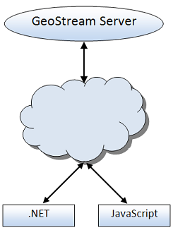 |
A range of .NET and JavaScript sample scripts, simple demonstrations, map styles, and fully-functional Visual Studio projects are provided. These can be used to get you up and running quickly with the GeoBase SDK, and include:
|  |
The GeoBase SDK provides an example GeoBase Web Service. This is in the form of a Visual Studio solution, and demonstrates how you can provide GeoBase operations as a Web Service, using SOAP messages. | 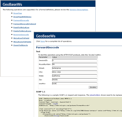 |
A comprehensive reference manual covering:
The manual offers many tutorials, walkthrough guides, and code samples to get you up and going quickly with GeoBase, and mapping software concepts. A web-based version of the latest GeoBase Help is also available online at http://docs.geobase.info |  |
Each installation has a set of release notes outlining the latest features, enhancements and fixes. The release notes are included as part of the GeoBase Help.